Getting to Svalbard
Your journey to the Norwegian Arctic is a big part of the adventure. With this helpful guide, you can embark on your trip with confidence.
Discover More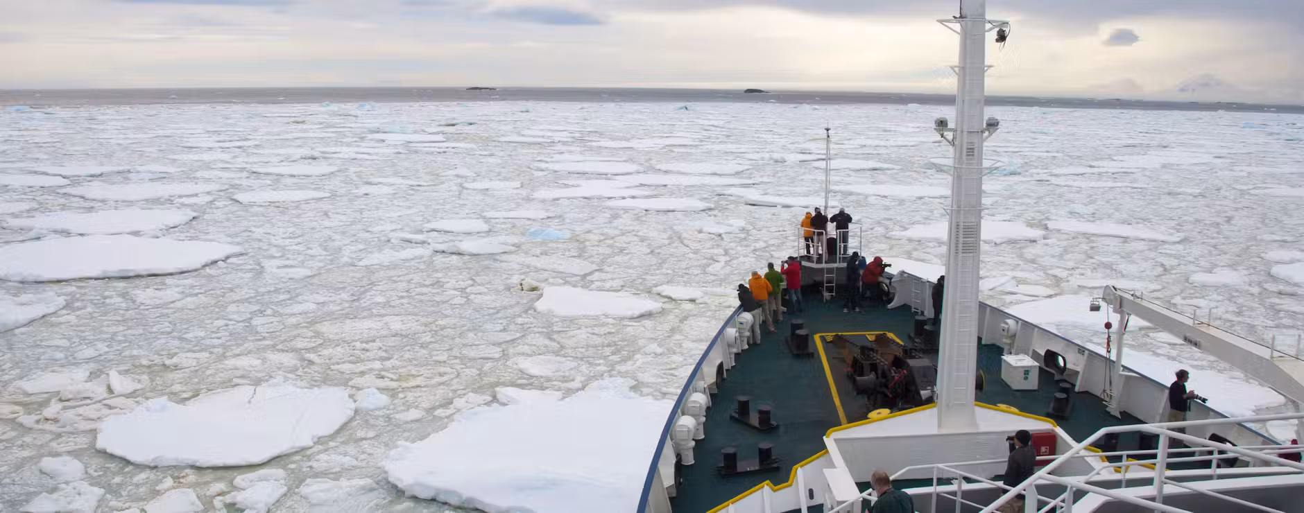
Whether you’re a birder or botanist, a photographer or trekker, a historian or hedonist – Svalbard’s astonishing multifacetedness is the ultimate Arctic crowd pleaser.
Nardus Erasmus Arctic Sales Specialist
Special Offers:Swoop has access to the widest range of offers and can help you find the right trip, cabin, & price.

This popular introduction to Svalbard is keenly priced and, with numerous early season departures, guarantees plenty of ice. Sail onboard one of the newest ships in polar waters and spot bears from the plentiful deck space. Optional kayaking and hiking…

Circumnavigate Spitsbergen on board a choice of two small ships and in the company of specialist guides. Travelling in such small groups allows you more time to explore, and some late-season departures benefit from stunning autumn light. Ask about special…

An intimate summer expedition circumnavigating Spitsbergen on a 12-guest micro ship. Feel connection to nature, with a sense of solitude and scale, which is harder to find on larger ships. Explore rarely-visited islands, glaciers and the polar desert in search…

Maximise wildlife sightings with the chance to circumnavigate Spitsbergen island. Search for walrus, arctic fox, whales and of course the ‘King of The Arctic'. Sail through the Hinlopen Strait and visit abandoned trapping stations and experience glaciers up close all…

Truly escape the modern world and explore Svalbard on board a schooner. Sail north through the melting spring ice, spot wildlife and learn about the archipelago’s rich history. Highlights include the Monaco Glacier, 17th century whaling settlements, close encounters with…

Circumnavigate Spitsbergen on board on a comfortable expedition ship and in the company of specialist guides. Travelling on a smaller ship allows you more time to explore, and some late-season departures benefit from stunning autumn light. Ask about special guest…
Scouting Svalbard’s ice floes for wildlife by zodiac and on foot, cruising the magnificent 14th of July glacier and reaching the world’s most northerly settlement at Ny Ålesund are just some of this 10-day voyage’s many highlights. There's also the…
Travelling in luxury aboard an outstanding expedition ship, we love this trip for its unusual combination of Svalbard and Norway’s northern tip, plus its focus on top-notch service and cuisine. After a hassle-free charter flight from Oslo to Svalbard, spend…

Experience the Arctic’s legendary wildlife aboard an intimate micro expedition ship, amidst a pristine backdrop of calving glaciers, and snow-capped mountains. With an unmatched sense of ‘expedition’ and a deeper connection to nature, you build your own adventure, searching for…
Let the midnight sun guide the way as you sail north to Phippsøya, just 540 miles from the geographical North Pole. En route you'll experience calving glaciers and teeming colonies of seabirds, walrus and whales, all while keeping a sharp…

Delivering a whopping 12 full days of exploration under the midnight sun, this voyage appeals to both wildlife enthusiasts keen to boost their chances of sighting Svalbard’s captivating fauna and the slow traveller who wants to get under the skin…

For a hassle-free, whistle stop introduction to the best of Svalbard, this week-long trip is hard to beat. Navigating Svalbard’s icy wilderness on board a comfortable expedition ship, blending breathtaking scenery with scientific discovery, while encountering polar bears, walruses and…

Spring travel in Svalbard is a real treat, particularly on board a 12-guest micro ship. Revel in being one of the earliest visitors with the whole archipelago largely to yourselves. Explore iced fjords, a landscape still shrouded in snow, and…
Svalbard is a living Arctic sanctuary, where wildlife thrives against a backdrop of ice and rugged landscapes. Polar bears roam the ice edge, walrus haul out on remote shores and reindeer and Arctic foxes traverse the tundra.
Beneath the waves, while whale numbers are still recovering, minke, beluga, and fin whales in particular are regularly sighted, while the occasional blue whale makes a majestic appearance.
In summer the skies come alive as millions of migratory birds arrive to nest, making Svalbard a true birding paradise.

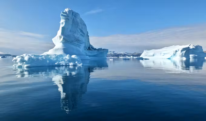
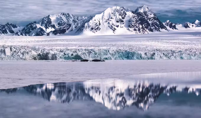
Gliding along Svalbard’s wild coastline feels like entering a silent world sculpted by ice and time. Towering, snow-capped mountains even in summer rise dramatically from the sea in serried rows, their jagged peaks mirrored in glassy waters.
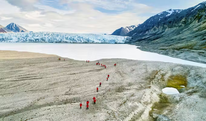
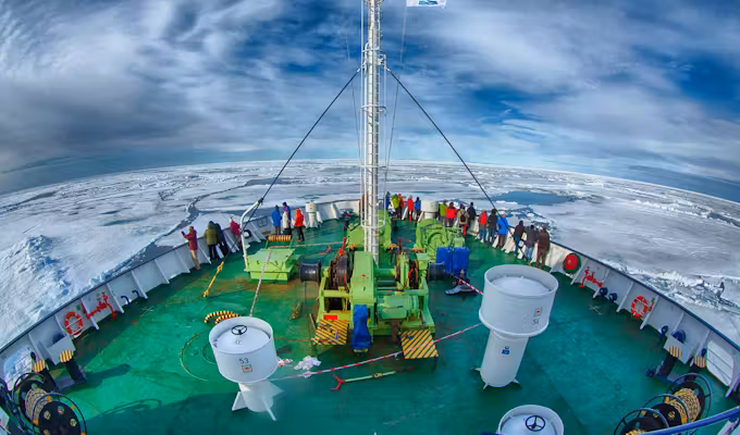
With over 60% of the archipelago cloaked in permanent ice, glaciers dominate the landscape, thundering as they calve into iceberg-strewn channels. Further north, the world transforms into an ethereal expanse of pack ice – a delicate crust of frozen sea – a magical never-never land.

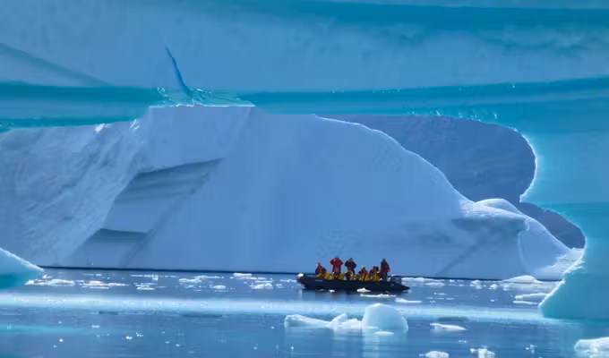
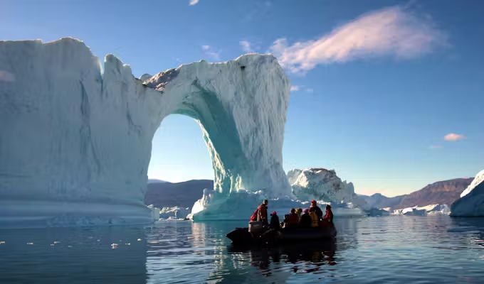
A zodiac cruises beside Monaco glacier
Experience the magic of Svalbard’s midnight sun, where summer reveals a world bathed in daylight 24 hours a day and the sun never sets. This surreal phenomenon might playfully shift your sense of time, but it quickly becomes exhilarating, opening the door to extended days for exploration.
With constant daylight, the opportunities for wildlife sightings – when they are at their most active during the summer months – and taking in your extraordinary surroundings at all times of day, are endless.

View of the pack ice
In over 20 years of polar travel, very few moments come anywhere close to the excitement of landing on the pack ice and being the most northerly ship on the planet at 82 degrees north.
Alex Mudd Head of Swoop Arctic
To be found off Svalbard’s north coast in summer, the pack ice stretches out to the horizon as a seemingly endless dazzling crust of pristine otherworldliness, broken only by narrow leads of dark, icy water. The silence is profound, punctuated only by the occasional groan of shifting ice.
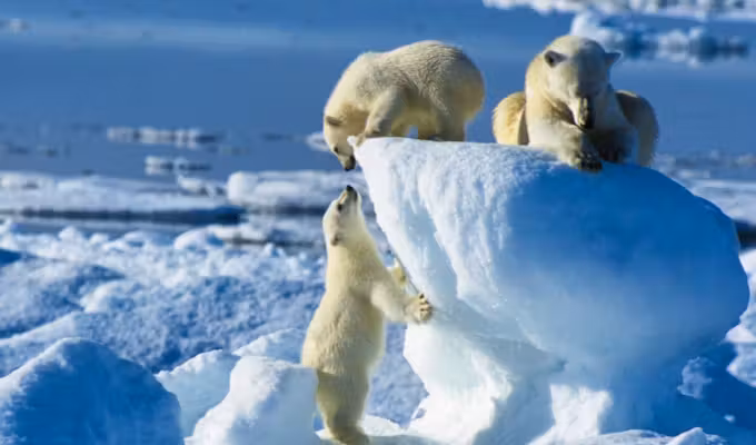
These frozen expanses are also well-known hunting grounds for hungry polar bear in search of ringed seal, and a day or two in the pack ice regularly features on many voyage itineraries.

Photographing a polar bear on the pack ice
Svalbard’s history is a gripping Arctic saga with many fascinating chapters. From Russian Pomor trappers who hunted walrus and fox centuries ago, to Dutch and British whalers. It was from Svalbard that explorers launched their bold expeditions in the race to be first to the North Pole. And at the beginning of the twentieth century, coal mining came to Svalbard.
Today, remnants of hunting camps, settlements, ships and mines continue to tell stories of survival, ambition and human ingenuity at the edge of the world.

Old whaler's hut on Svalbard
Your journey to the Norwegian Arctic is a big part of the adventure. With this helpful guide, you can embark on your trip with confidence.
Discover More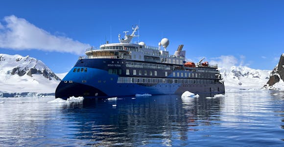
In the absence of hotels and infrastructure once you depart Longyearbyen, an expedition ship offers the best means to explore Svalbard's ragged coastline, while acting as both your…
Discover More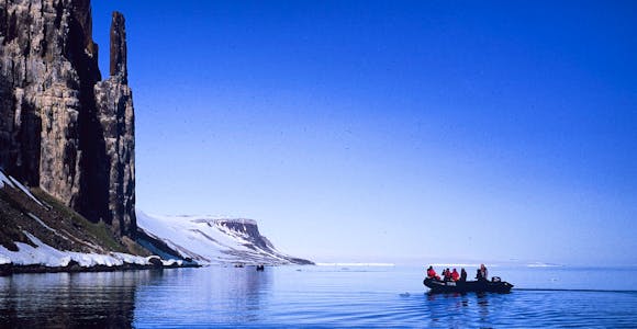
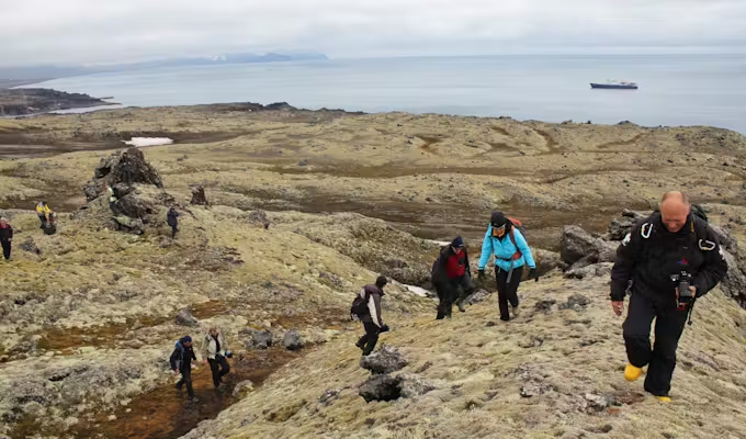
Expedition cruising is all about active exploration - trekking the arctic tundra, watching for wildlife, studying Svalbard’s history or sailing through sea ice, and accompanied …
Discover More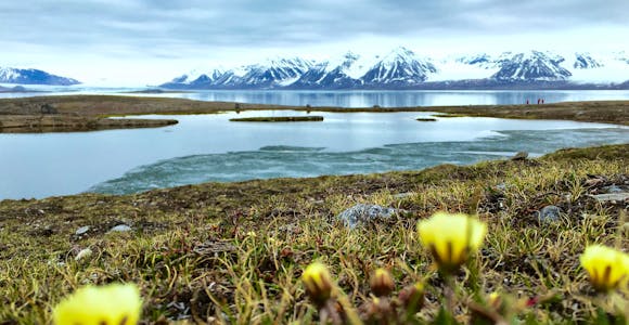
While Svalbard may be an almost year round destination, the changing weather, number of daylight hours, amount of ice and snow conditions through the year all have a marked effect …
Discover MoreDaily scheduled flights via Oslo make Svalbard easier and cheaper to reach than almost any other Arctic region. For even easier and more seamless travel, many of our voyages include direct charter flights to Longyearbyen from Oslo, Helsinki or Paris.
As the name suggests these shorter trips (7-10 days) offer an excellent introduction to Svalbard, with daily off-ship excursions and good opportunities for wildlife sightings.
Special Offers:Swoop has access to the widest range of offers and can help you find the right trip, cabin, & price.
Let the midnight sun guide the way as you sail north to Phippsøya, just 540 miles from the geographical North Pole. En route you'll experience calving glaciers and teeming colonies of seabirds, walrus and whales, all while keeping a sharp…

For anyone keen to experience Svalbard’s rich Arctic wildlife and spectacular scenery while travelling comfortably, this is a good option. Travelling in the company of naturalists on board a modern state-of-the-art ship, equal attention is given to your experience both…
Truly escape the modern world and explore Svalbard on board a schooner. Sail north through the melting spring ice, spot wildlife and learn about the archipelago’s rich history. Highlights include the Monaco Glacier, 17th century whaling settlements, close encounters with…

Explore the fjords and ice of Svalbard keeping a close watch for polar bears onboard an exceptional expedition ship. Spend time on deck, on land and in zodiacs with the hugely experienced guides learning about the history, geology and wildlife…
Using the ship as your comfortable ‘basecamp’ and travelling slower to enable more time for exploring each location – on foot, by kayak and through the lens of your camera – this is an ideal trip for the active traveller seeking quality…
For a stellar introduction to all Svalbard has to offer, travel on board a modern X-Bow ship with a maximum of just 130 guests while accompanied by one of the best expedition teams in the business. Complimentary charter flights and…

May is springtime in Svalbard and for those travellers looking for pristine, fairytale snowy landscapes, icy fjords and a world – and wildlife – re-awakening after the long winter slumber, it’s a magical time. Travelling onboard a small ship with…

For the Rolls-Royce of expeditionary cruising in Svalbard, travel with the original pioneers of polar exploration on this trip. Traversing Svalbard aboard one of the most advanced small expedition ships afloat and accompanied by your unparalleled onboard expedition team, expeditionary…
Spring travel in Svalbard is a real treat, particularly on board a 12-guest micro ship. Revel in being one of the earliest visitors with the whole archipelago largely to yourselves. Explore iced fjords, a landscape still shrouded in snow, and…

Circumnavigate the largest island in the Svalbard archipelago, cruising as far as 80° North to reach the edge of the pack ice. This voyage includes an impressive eight days of off-ship exploring, with ample opportunities to spot remarkable Arctic wildlife…

Experience Arctic summertime at its best on this immersive expedition, travelling aboard a modern X-Bow ship built for a smoother ride through polar waters. Keep watch for walruses, whales and, with luck, polar bears as you venture towards the sea…
If you’re looking for a good value introduction to Svalbard, travelling on a sturdy, older ship with bags of charm and history, this is a good option to consider. Spend six full days exploring and learning about Svalbard’s rich history…

Guided by Rinie van Meurs, renowned Arctic expedition leader with over 30 years of experience ,and travelling onboard a small, comfortable and very capable 12-guest ship, this short eight-day voyage is ideal for the Arctic traveller who is looking for…

This immersive 10-day Svalbard voyage stands out as it's guided by Rinie van Meurs, renowned Arctic expedition leader with over 30 years of experience, and travels onboard a small, comfortable and very capable 12-guest ship. Travelling slowly, maximising time on…

For those who value comfort without the formality, this all-inclusive Svalbard expedition offers a relaxed introduction to the High Arctic. The ship’s contemporary Scandinavian-inspired design provides a stylish and comfortable base from which to explore by zodiac, on foot and…
For a hassle-free, whistle stop introduction to the best of Svalbard, this week-long trip is hard to beat. Navigating Svalbard’s icy wilderness on board a comfortable expedition ship, blending breathtaking scenery with scientific discovery, while encountering polar bears, walruses and…
These longer trips (11-14 days) not only improve your chances of wildlife sightings, but the later departures also offer the opportunity to do a full circumnavigation of Spitsbergen.
Special Offers:Swoop has access to the widest range of offers and can help you find the right trip, cabin, & price.

Travelling at the height of summer, this trip is the longest of any Svalbard cruise and offers the best possible conditions for thrilling wildlife encounters. Your circumnavigation of Spitsbergen includes huge glaciers, epic bird cliffs and ice-choked channels. Plus, there's…
An intimate summer expedition circumnavigating Spitsbergen on a 12-guest micro ship. Feel connection to nature, with a sense of solitude and scale, which is harder to find on larger ships. Explore rarely-visited islands, glaciers and the polar desert in search…
Circumnavigate Spitsbergen on board on a comfortable expedition ship and in the company of specialist guides. Travelling on a smaller ship allows you more time to explore, and some late-season departures benefit from stunning autumn light. Ask about special guest…
Maximise wildlife sightings with the chance to circumnavigate Spitsbergen island. Search for walrus, arctic fox, whales and of course the ‘King of The Arctic'. Sail through the Hinlopen Strait and visit abandoned trapping stations and experience glaciers up close all…
Delivering a whopping 12 full days of exploration under the midnight sun, this voyage appeals to both wildlife enthusiasts keen to boost their chances of sighting Svalbard’s captivating fauna and the slow traveller who wants to get under the skin…
Experience the Arctic’s legendary wildlife aboard an intimate micro expedition ship, amidst a pristine backdrop of calving glaciers, and snow-capped mountains. With an unmatched sense of ‘expedition’ and a deeper connection to nature, you build your own adventure, searching for…
This popular introduction to Svalbard is keenly priced and, with numerous early season departures, guarantees plenty of ice. Sail onboard one of the newest ships in polar waters and spot bears from the plentiful deck space. Optional kayaking and hiking…

If you’re looking for an in-depth Svalbard voyage to optimise wildlife encounters and provide a really immersive experience, while not wanting the budget to run away from you, this is a good option. What this cosy 128-guest ship may not…

Travelling during the height of summer, the goal is to complete a full circumnavigation of the Svalbard archipelago. But what really marks this voyage out is the rare inclusion of the remote and little-visited island of Kvitøya, renowned as a…

Travelling during the height of summer under the ever present midnight sun, and with wildlife activity at its peak, this in-depth Svalbard voyage also offers the possibility of undertaking a circumnavigation of Spitsbergen, if ice and weather conditions allow. Maximum…

This exclusive 13-day voyage is guided by renowned Arctic expert, Rinie van Meurs, who has over 30 years of experience. While travelling onboard a small, capable and cosy 12-guest ship, his deep knowledge and passion will bring the Arctic and…
While Svalbard has more than enough appeal to keep you captivated, there are also some spectacular longer trips (14-24 days) which combine Svalbard with its near neighbours.
Special Offers:Swoop has access to the widest range of offers and can help you find the right trip, cabin, & price.
Introductions to the High Arctic don’t come much better. Traverse wildlife-rich Svalbard via East Greenland’s towering icebergs and autumnal tundra, then continue on to Iceland. Aurora sightings are possible at any point.…
Beginning in Svalbard before sailing west across the Greenland Sea and exploring Greenland’s long eastern coastline to finish in Iceland, this is an audacious Arctic journey of startling diversity and contrast. Spectacular landscapes, towering glaciers and once-in-a-lifetime wildlife encounters all…
This comprehensive Arctic triumvirate encompassing Svalbard, East Greenland and Iceland offers the best of the Arctic: some of the best wildlife viewing with spectacular scenery, unspoiled fjords, gigantic icebergs and Inuit communities. You may also be lucky enough to see…
Beginning deep inside the High Arctic and finishing in subarctic Iceland, we like this voyage for its diversity, sense of journey and extended time exploring East Greenland. Zodiac cruising among towering icebergs, glimpsing the Northern Lights and tracking musk oxen…
Travelling in luxury aboard an outstanding expedition ship, we love this trip for its unusual combination of Svalbard and Norway’s northern tip, plus its focus on top-notch service and cuisine. After a hassle-free charter flight from Oslo to Svalbard, spend…

Reach the top of the world in serious comfort onboard a state-of-the-art luxury, hybrid-powered icebreaker. Travel north through icebound waters and join the exclusive list of intrepid explorers who have visited the geographical North…
Setting sail from Scotland, this iconic journey island hops its way northwards before bisecting the Arctic Circle and spending time exploring the captivating Arctic archipelago of Svalbard. The little-visited islands of Fair Isle and Jan Mayen are a real treat,…

Walrus hauled out on the ice

Bears exploring the sea ice

Stunning glacier face

Photographing the pack ice

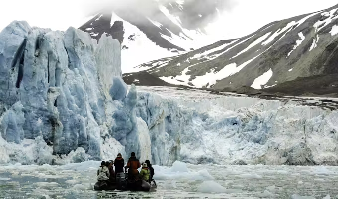
Navigating through pack ice

Glacier calving at Svalbard

Guillemots at Alkefjellet

Reindeer at Svalbard

Walrus colony with kittiwakes

Curious foxes on Svalbard

View across the Arctic tundra

Kayaking on a mirror lake

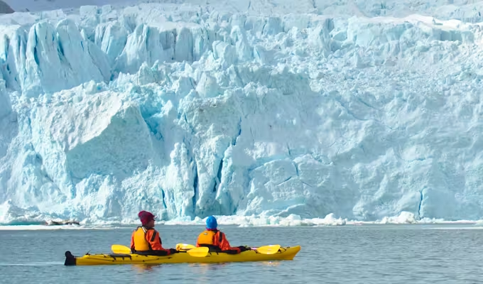
Kayaking close to a glacier

Polar bear roaming on the snow

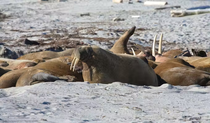
Walrus in Svalbard
We'll spend some time listening to your aspirations, then discuss the kind of experience that might suit you.
Next we'll discuss the options, shortlist the best trips for you and present you our impartial recommendations.
We'll place a 24 hour hold on your preferred option - without obligation - whilst we talk through the details.